Monday, June 27, 2016

Catch me if you can or…


Ketchikan.

As we approached Ketchikan we were alongside the airport – one of the shortest runways that I have seen. At the bottom on the river was a floater plane docking area so I entertained myself taking pictures of landings and take offs.

sadly typical of many areas in Alaska

This stop we had to “dock” in the river itself as one of the docks had been damaged two weeks earlier when the local pilot rammed into it. We got the real story on how it happened from a local: as is the case throughout the Inside Passage, the ship’s captain is not allowed to pilot within National Parks nor dock at some cities, so the local pilot had boarded and was in command. Ketchikan has 4 docks and this particular cruise ship was coming in at an angle where clearance with a cruise ship docked was very little. Winds were blowing 80 mph (approx. 120 km/h) and starting to shove him into the other cruise ship so he chose to pick up speed and ram the dock instead of hitting the other ship – the best choice in a sticky situation. In any case it meant that we got to tender in to the city thus also seeing what the lifeboats were like. Later they were able to dock when another of the 4 of us left so we didn’t have to tender back out at the end of the day.

Approaching the Ketchikan docks

Tying up a floater plane

The airport just above Ketchikan is reached by ferry and has a very short runway!

Here my brother had organized another rental car and the area is so small that they simply brought our car to the dock! We first traveled the South Road to it’s end – some 12 miles, seeing a deer and visiting Rotary Beach with lots of driftwood and as tide was fairly low we also could tide pool – crabs of several kinds, mussels and other marine life. We then returned to town and took the North Road for another 19 miles! At its’ end was a Rain Forest – Settler’s Cove where we took a walk and skipped some rocks into the bay.

Deer crossed the road in front of us

The end of the road South

Bald Eagle on a log near the hatchery

Rotary Beach

"The" tunnel: one can go through it, around it and over it.

The end of the North Road

Water fall in the rain forest

One more stop was the Bight Totem park where they have reproduced a Clan house and approx. 20 old Tlingit and Haida totem polls.

Baby Bear totem pole at Bight

Back in the center of town we left the car at the dock as instructed and walked around searching desperately for food. Slim pickings and finally ended up in a bar cum restaurant all dark with lousy service. One positive – wifi – and I was finally able to check e-mails and post a blog!

Quickly hit a few souvenir stores on the way back to the boat then we were off for our last leg – no shore stops – to Vancouver, Canada along the Tongass Narrows. Weather again cleared up and warm.

Damaged Dock under repair

Floater planes parked outside houses


No description necessary

Saturday, June 25, 2016

Juneau – capital of the state of Alaska and


Bald Eagle gathering spot: the first one being on a lamp post right off the ship, which funnily enough is the only one that was easy enough to take a photo.

Bald Eagle waiting at the fish packaging plant

As we hadn’t rented a car for this stop due to the short time, we debated upon simply walking around town (quaint with wooden one and two-story buildings) or taking a locally organized tour to the Mendenhall Glacier, whale watching among other offerings.  In the end we settled for the whale watching without the glacier in hopes of having a bit of time in town afterwards. This was an excellent choice!

Our bus driver out, whose name I neglected to memorize, was a great source of information (another one who had only been here months) with many a joke. Our boat, run by Juneau Tours, a fairly recent one and the two guides on board, Emily and Jon not only good ones, but very enthusiastic ones as well. The pilot, although mostly unseen by me as I never got on the top deck, did an excellent job as well

Once out where we were most likely to spot whales, sure enough, mother Flame with her latest baby (she has had 7 – one every three years) were into performing. Now have you ever tried to take pictures of wild animals in the water from a boat that’s rolling? Not an easy task I can assure you, still we probably managed several thousands in the hour and a half that we were out. I also didn’t know that each whale has an individual tail – similar to our finger prints – so that it is easy for the naturalists to name and recognize them.

Dock at Auk Bay

Krill, which is what the giants feed on - but millions at a time

A whale's tail

blowing and rolling

Mom and baby
They were rolling, splashing but not jumping
Just cruising along
Mom and baby

"Flame"'s tail
On the way into the docks in Auk Bay we also swung by a buoy with Stellar sea lions “sunning” themselves.


Then we got another of my famous pieces of “luck” when the bus driver, Brandy, announced that her bus would be swinging by the Mendenhall Glacier on the way back into town so we got a view for free – and given the amount of busses and tourists massed in the turn around it’s a good thing we hadn’t opted for that tour.

Mendenhall Glacier
Back in Juneau we found the statue to “Patsy Ann”, a deaf dog who belonged to the town and who always knew when a boat was coming in and faithfully greeted them. Thereafter I walked up to the Post Office to mail some post cards then discovered a coffee shop with wi-fi and was able to post one blog and check on e-mails.

Patsy Ann

Back on board we were delayed by two missing persons and left almost an hour late.
But never mind, the balloons were loaded and there was a balloon drop to much amusement and noise before we literally sailed off with the sun setting behind us.

I loved watching the floater planes land and take off

I loved watching the floater planes land and take off
Before the Balloon Drop

After the Balloon Drop
Our boat as we returned in the afternoon
Sunset as we headed toward Ketchikan

Friday, June 24, 2016

Docked where I can touch the trees


It is very weird to wake up, look out one’s window (these are true windows and even if I have an “obstructed view”: read – a lifeboat in front of my nose – it is a full-sized window and not just a porthole) and see trees close enough to touch! We had arrived in Skagway, docking before anyone was awake to see it.

We had rented a car for the day, but the first thing we noticed on our way into town was that the busses had double license plates: American and Canadian. They travel across the border so often that they need to have both. The second thing were the painted and inscribed rocks along the cliff where we were docked – we never did find out the why’s for this, but most seemed to be dedicated to captains and perhaps it was simply more visible this way, as well as being more durable, because although we are enjoying a spate of good weather, this is definitely not the case normally. Another thing I finally took a picture of was of one of the numerous espresso huts. Starbucks has made its' way everywhere, but the Alaskans still have their huts around most corners: walk up, order and take away - no room for sitting.

Dock in Skagway

double license plates

rock inscriptions
espresso hut - with gifts

At the beginning we had thought that Whitehorse was an easy destination of about 65 miles, but we found throughout the day that nothing was as it seemed and that every bit of information gleaned from phones, maps and road signs was conflicting! Of course the problem of having miles on one side and kilometres on the other didn’t help, nor did the changing from Alaska time to Pacific Standard time: another day and we would have been so confused that we would have attempted nothing!

As it was we headed for Whitehorse over the summit on the South Klondike Highway, stopping in every turn out existing. The terrain was high altitude although the summit was only 2’865 feet (873 m). The history of the building of the wagon trail, the railroad (funded by British backers Michael Heney using 35’000 workers – finished it in 26 months!) and the road is a saga.

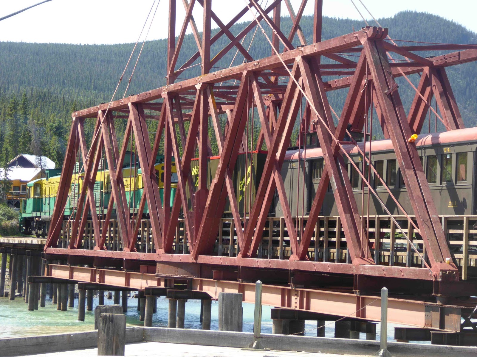
Train tracks on the opposite side

Trestle bridge for the train
 We crossed into Canada and were for a bit in BC (British Columbia) before entering the Yukon territory: along the way water falls too numerous to count and – for want of a better description – alpine lakes by the hundreds of all sizes and mostly deep blue as well as granite mountains.

One of hundreds of waterfalls

One of hundreds of alpine lakes, each one prettier than the last
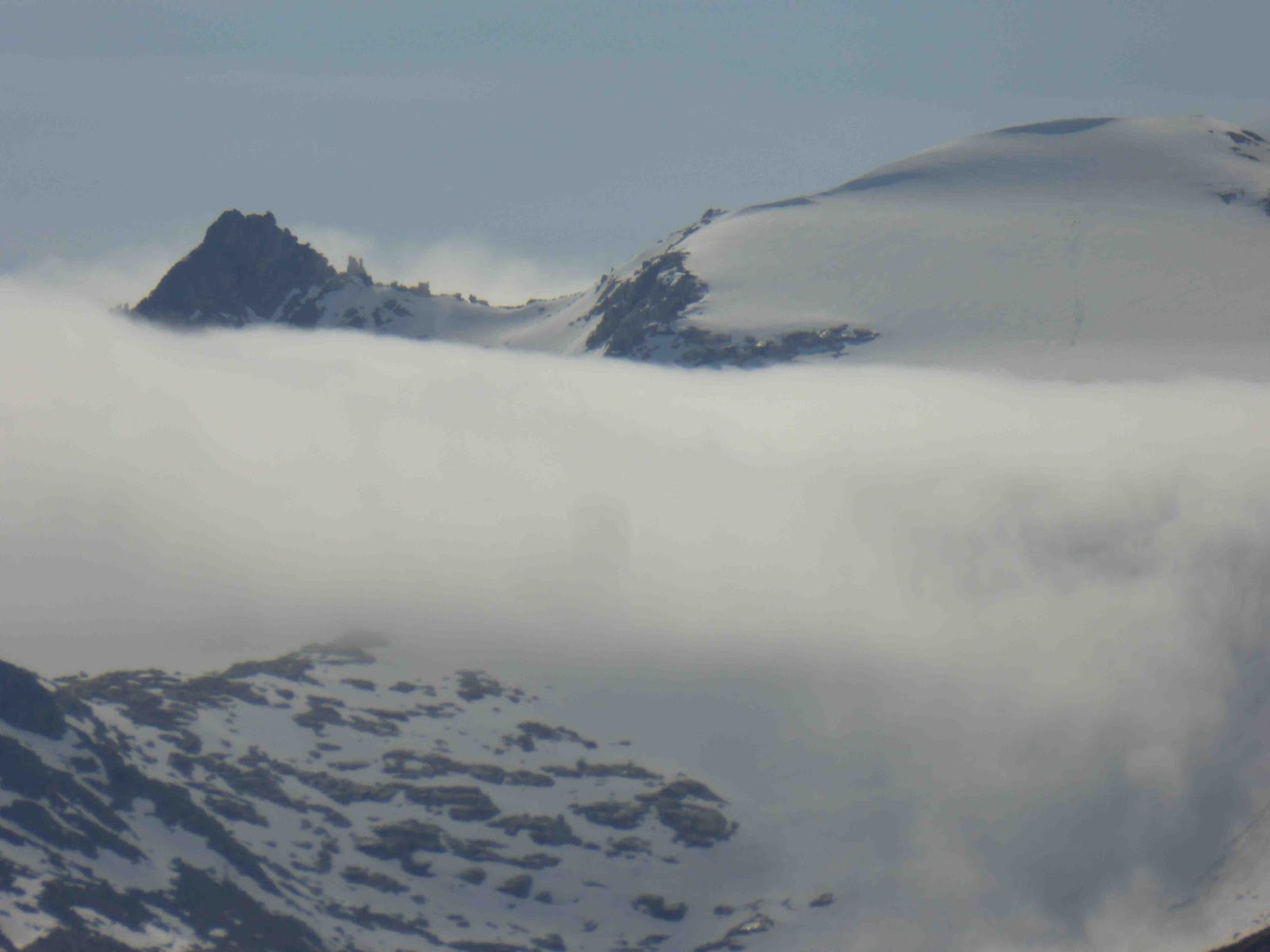
Peaks playing with the clouds

Lake Tutshi

Windy Arm

Windy arm

Bove Island

We stopped in Carcross, which was originally called Caribou Crossing due to the immense herds of caribou: there we visited the train station, discovered the totems of Keish – a native to Carcross – as well as the world’s smallest “desert” an area of sand dunes caused by the find grinding of glacial rocks then continued on to Emerald Lake – one of the world’s most beautiful as due to silt, the sun and various other elements it has rainbow colors that my photos couldn’t capture in their entirety.

 
Carcross and the only caribou we saw.


Train bridge at Carcross with the White Pass & Yukon train.

Abandoned structures disintegrate quickly

One of many Keisha Totems

The world's smallest desert

Emerald Lake

Emerald Lake
We traveled on to Whitehorse – a name attributed to this city as the natives thought that the rapids just out of town resembled a white horse’s mane: the rapids no longer exist having been turned into a source of energy. There we had a quick lunch and picked up e-mails (I had been off-line for 72 hours at that point – unheard of!) before heading back.

On the way we stumbled across a bear right at the side of the road: as he was young and intent on eating the grass we rolled down our windows and this photo was taken about 3 feet from him!

about a meter (yard) from our car!

After turning in the car we walked back to our cruise ship and watching them cast off (a process in itself) before leaving Skagway and returning back down the Lynn canal.
Truly a memorable drive and day: oh, did I mention – the thermometer hit 80°F (27°C) in Whitehorse!

The Lynn Canal

Leaving Skagway